
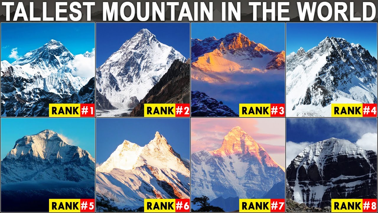
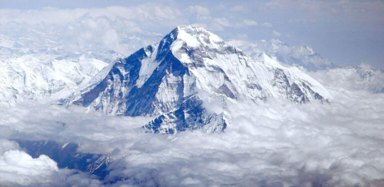
1. Mount Everest
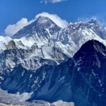
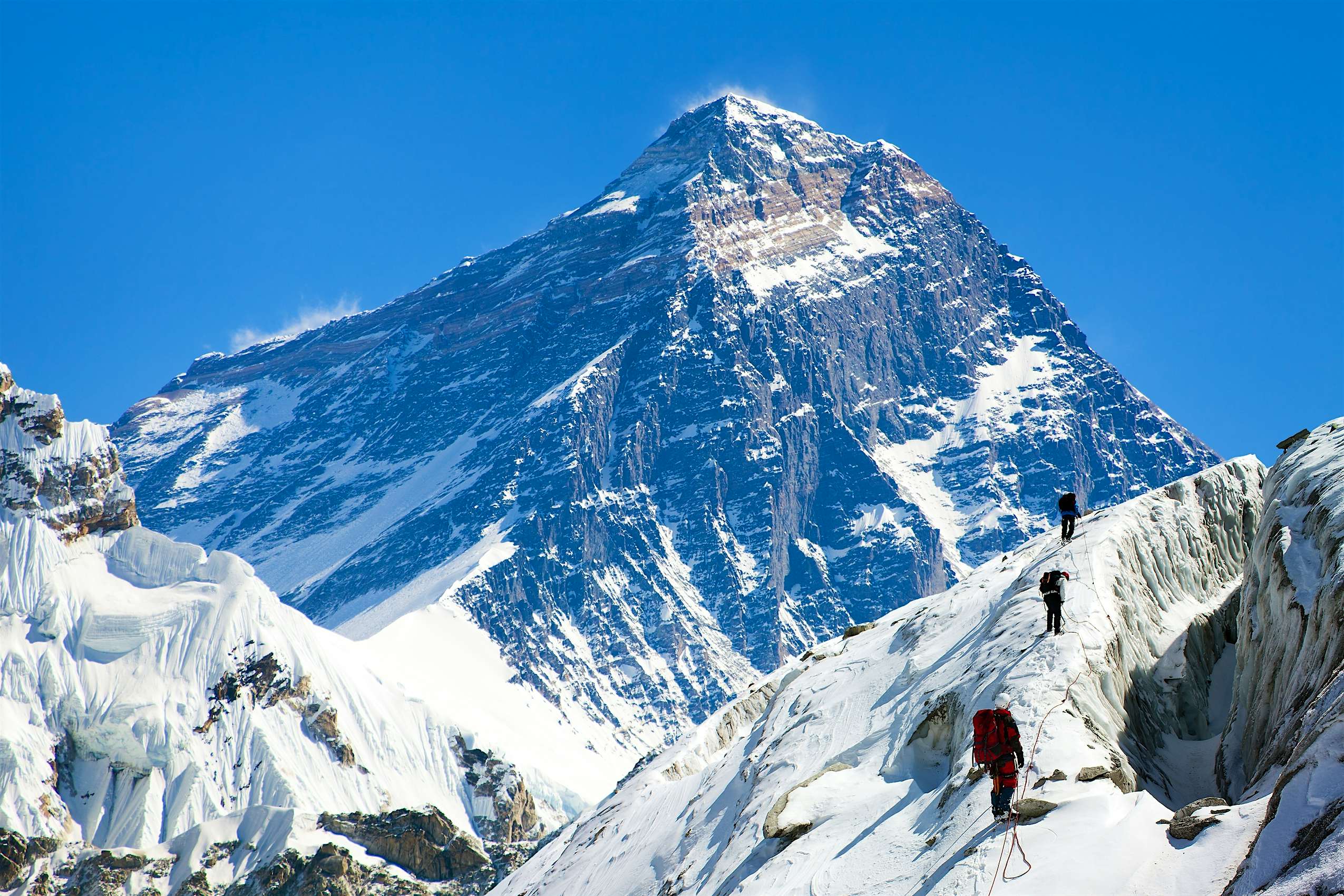
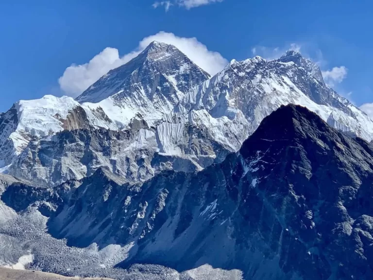
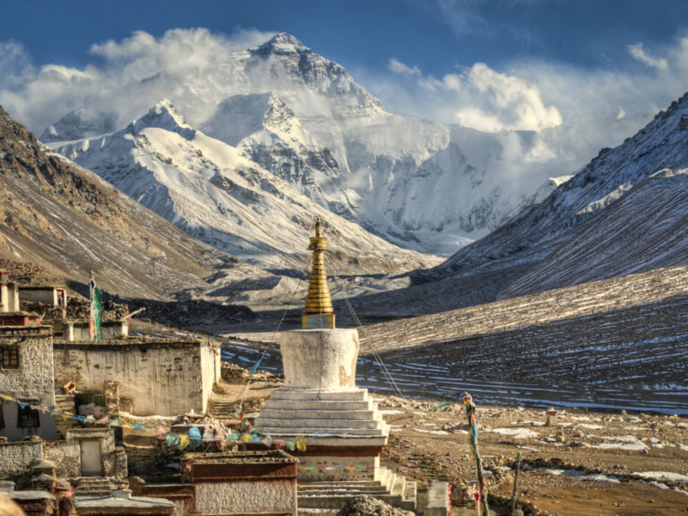
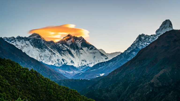
Stood at the south part of Tingri County in southern Tibet, Mt. Everest, or Qomolangma in Tibet, is the highest mountain of the world. With a height of 8,848 m above sea level, this mountain is permanently covered with snow. Its body assumes the shape of a pyramid with its peak stabbed the sky. Its snow peak sends out silver radiance year after year. Its waist is hidden in the clouds. As the earth’s highest mountain, it is the ultimate goal of every mountain lovers. The optimum weather to visit Mt. Everest is from April to June, a golden period for mountaineers. But due to its complicated and volatile natural environment, it is actually a tough job even for those well-experienced mountaineers.
![a-sweeping-panorama-of-mount-everest-at-the-last-light-in-sagarmatha-national-park--nepal--73265303-5aece502119fa80037690d37[1]](https://hobbymart.net/wp-content/uploads/2022/03/a-sweeping-panorama-of-mount-everest-at-the-last-light-in-sagarmatha-national-park-nepal-73265303-5aece502119fa80037690d371-768x489.jpg)

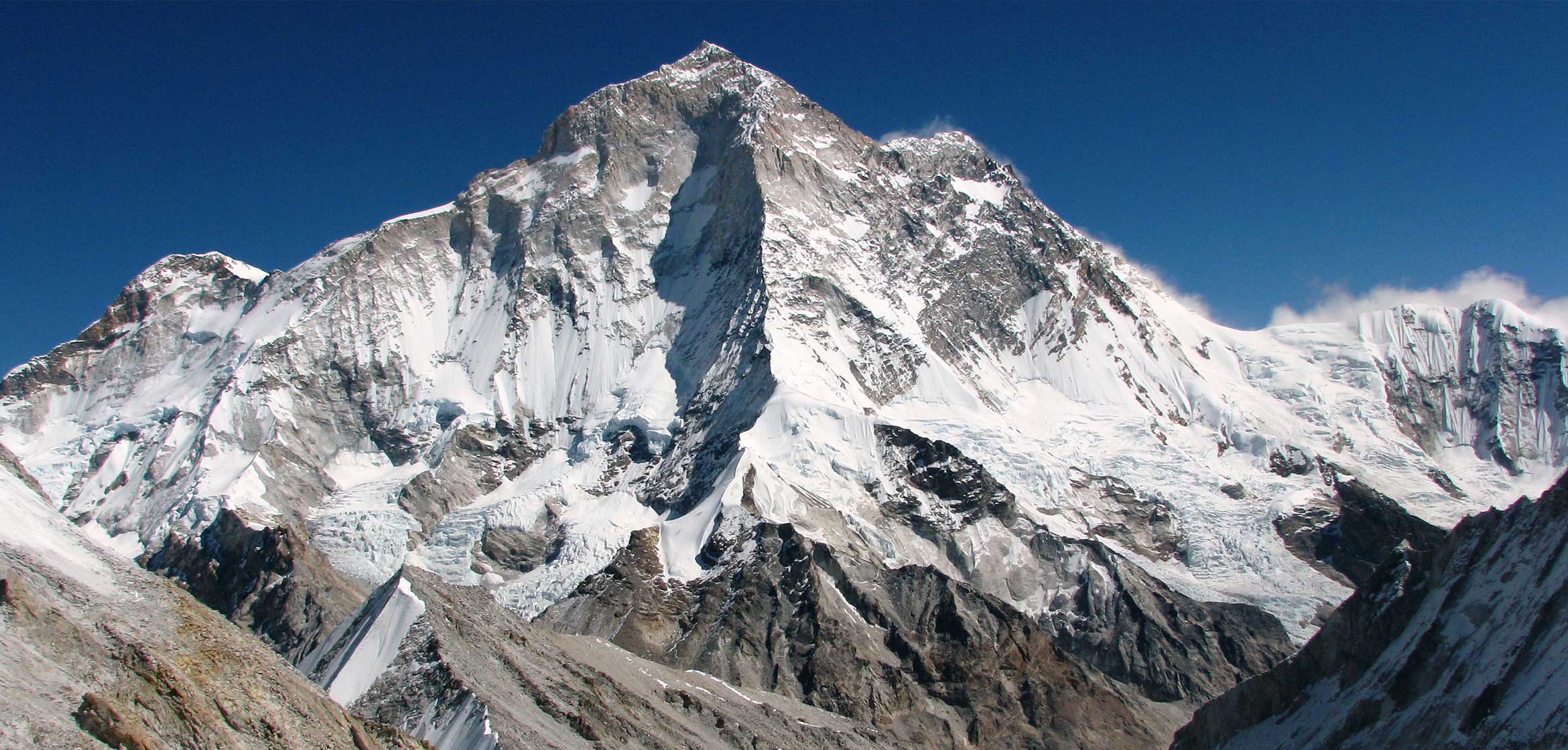
2. Mount K2
K2, at 8,611 metres (28,251 ft) above sea level, is the second-highest mountain on Earth, after Mount Everest (at 8,849 metres (29,032 ft)). It lies in the Karakoram range, partially in the Gilgit-Baltistan region of Pakistan-administered Kashmir and partially in a China-administered territory of the Kashmir region included in the Taxkorgan Tajik Autonomous County of Xinjiang. K2 also became popularly known as the Savage Mountain after George Bell—a climber on the 1953 American expedition—told reporters, "It's a savage mountain that tries to kill you." Of the five highest mountains in the world, K2 is the deadliest; approximately one person dies on the mountain for every four who reach the summit. Also occasionally known as Mount Godwin-Austen, other nicknames for K2 are The King of Mountains and The Mountaineers' Mountain, as well as The Mountain of Mountains after prominent Italian climber Reinhold Messner titled his book about K2 the same.
![267190,xcitefun-k2-pakistan-4[1]](https://hobbymart.net/wp-content/uploads/2022/03/267190xcitefun-k2-pakistan-41-768x503.jpg)
![2-14[1]](https://hobbymart.net/wp-content/uploads/2022/03/2-141-768x576.jpg)
![737837[1]](https://hobbymart.net/wp-content/uploads/2022/03/7378371-768x576.jpg)
3. Mount Kangchenjunga
Kangchenjunga, also spelt Kanchenjunga, is the third highest mountain in the world. It rises with an elevation of 8,586 m (28,169 ft) in a section of the Himalayas called Kangchenjunga Himal delimited in the west by the Tamur River, in the north by the Lhonak Chu and Jongsang La, and in the east by the Teesta River. It lies between India and Nepal, with three of the five peaks, namely Main, Central and South, directly on the border, and the peaks West and Kangbachen in Nepal's Taplejung District. Until 1852, Kangchenjunga was assumed to be the highest mountain in the world, but calculations based on various readings and measurements made by the Great Trigonometrical Survey of India in 1849 concluded that Mount Everest, known as Peak XV at the time, was the highest. Allowing for further verification of all calculations, it was officially announced in 1856 that Kangchenjunga is the third highest mountain in the world. Kangchenjunga was first climbed on 25 May 1955 by Joe Brown and George Band, who were part of the 1955 British Kangchenjunga expedition. They stopped short of the summit following the promise given to the Chogyal that the top of the mountain would remain inviolate.
![Kangchenjunga-India[1]](https://hobbymart.net/wp-content/uploads/2022/03/Kangchenjunga-India1-768x514.jpg)
![kangchenjunga-1[1]](https://hobbymart.net/wp-content/uploads/2022/03/kangchenjunga-11-768x514.jpg)
![9618b63154476cf210ed4c97512805cd[1]](https://hobbymart.net/wp-content/uploads/2022/03/9618b63154476cf210ed4c97512805cd1-768x462.jpg)
4. Mount Lhotse
Lhotse (Nepali: ल्होत्से L'hōtsē Nepali pronunciation: [lot.se]; Tibetan: ལྷོ་རྩེ Tibetan pronunciation: [l̥otse], lho tse, Chinese: 洛子峰) is the fourth highest mountain in the world at 8,516 metres (27,940 ft), after Mount Everest, K2, and Kangchenjunga. The main summit is on the border between Tibet and the Khumbu region of Nepal. With Everest to the north and Nuptse to the west, Lhotse forms the apex of the massive horseshoe-shaped arc of the Everest massif. Despite the tremendous vertical relief of its South and Northeast Faces, it is the least prominent of the eight-thousanders due to the great height of the South Col between it and Everest. Lhotse’s Western Face, recessed behind the head of the Khumbu Glacier in the Western Cwm, plays an integral part in the standard routes of ascent for both peaks; the name Lhotse, which means "South Peak" in Tibetan, further emphasizes the close relationship between the two.
![mount_lhotse_expedition_146787569278[1]](https://hobbymart.net/wp-content/uploads/2022/03/mount_lhotse_expedition_1467875692781-768x486.jpg)
![811301[1]](https://hobbymart.net/wp-content/uploads/2022/03/8113011-768x576.jpg)
![lhotse-expedition[1]](https://hobbymart.net/wp-content/uploads/2022/03/lhotse-expedition1.jpg)
5. Mount Makalu
Makalu[2] (Chinese: 馬卡魯峰; pinyin: Mǎkǎlǔ fēng; Nepali: मकालु हिमाल, romanized: Makālu himāl) is the fifth highest mountain in the world at 8,485 metres (27,838 ft). It is located in the Mahalangur Himalayas 19 km (12 mi) southeast of Mount Everest, on the border between Nepal and Tibet Autonomous Region, China. One of the eight-thousanders, Makalu is an isolated peak whose shape is a four-sided pyramid. Makalu has two notable subsidiary peaks. Kangchungtse, or Makalu II (7,678 m) lies about three kilometres (two miles) north-northwest of the main summit. Rising about 5 km (3 mi) north-northeast of the main summit across a broad plateau, and connected to Kangchungtse by a narrow, 7,200 m saddle, is Chomo Lonzo (7,804 m)
![811302[1]](https://hobbymart.net/wp-content/uploads/2022/03/8113021-768x548.jpg)
![maxresdefault[1]](https://hobbymart.net/wp-content/uploads/2022/03/maxresdefault1-6-768x432.jpg)

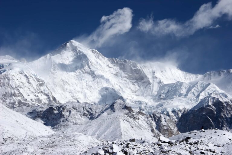
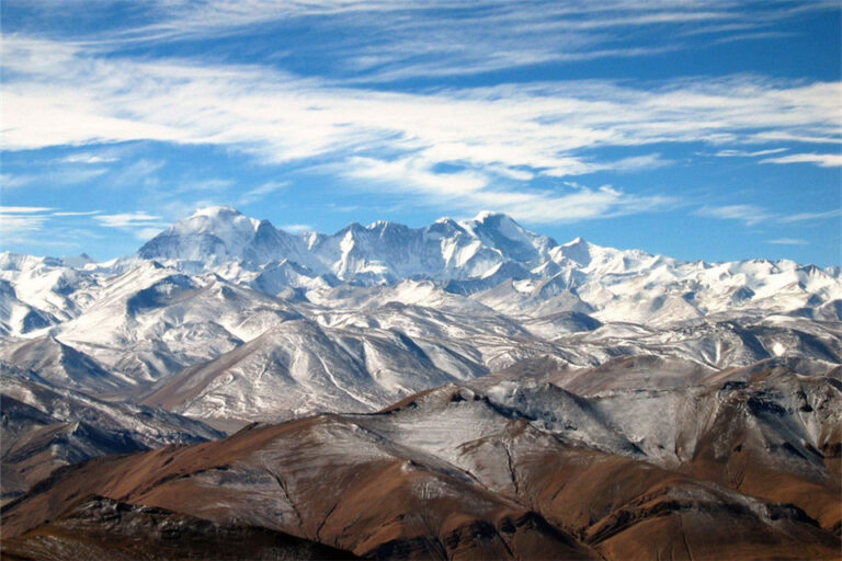
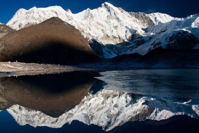
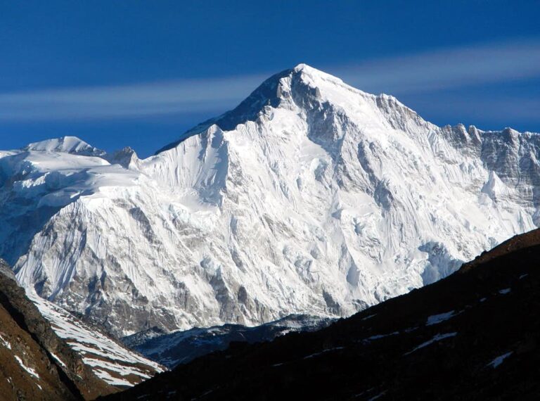
6. Mount Cho Oyu
Cho Oyu (Nepali: चोयु; Tibetan: ཇོ་བོ་དབུ་ཡ; Chinese: 卓奥友峰) is the sixth-highest mountain in the world at 8,188 metres (26,864 ft) above sea level. Cho Oyu means "Turquoise Goddess" in Tibetan. The mountain is the westernmost major peak of the Khumbu sub-section of the Mahalangur Himalaya 20 km west of Mount Everest. The mountain stands on the China–Nepal border. Just a few kilometres west of Cho Oyu is Nangpa La (5,716m/18,753 ft), a glaciated pass that serves as the main trading route between the Tibetans and the Khumbu's Sherpas. This pass separates the Khumbu and Rolwaling Himalayas. Due to its proximity to this pass and the generally moderate slopes of the standard northwest ridge route, Cho Oyu is considered the easiest 8,000 metre peak to climb.[3] It is a popular objective for professionally guided parties.

7. Mount Dhaulagiri
Dhaulagiri is the seventh highest mountain in the world at 8,167 metres (26,795 ft) above sea level, and the highest mountain within the borders of a single country (Nepal). It was first climbed on 13 May 1960 by a Swiss-Austrian-Nepali expedition. Annapurna I (8,091 m (26,545 ft)) is 34 km (21 mi) east of Dhaulagiri. The Kali Gandaki River flows between the two in the Kaligandaki Gorge, said to be the world's deepest.[citation needed] The town of Pokhara is south of the Annapurnas, an important regional center and the gateway for climbers and trekkers visiting both ranges as well as a tourist destination in its own right.
![Dhaulagiri_mountain-west-face[1]](https://hobbymart.net/wp-content/uploads/2022/03/Dhaulagiri_mountain-west-face1-768x576.jpg)
![Mount-Dhaulagiri_southface[1]](https://hobbymart.net/wp-content/uploads/2022/03/Mount-Dhaulagiri_southface1.jpg)
![Dhaulagiri_southface[1]](https://hobbymart.net/wp-content/uploads/2022/03/Dhaulagiri_southface1-768x384.jpg)

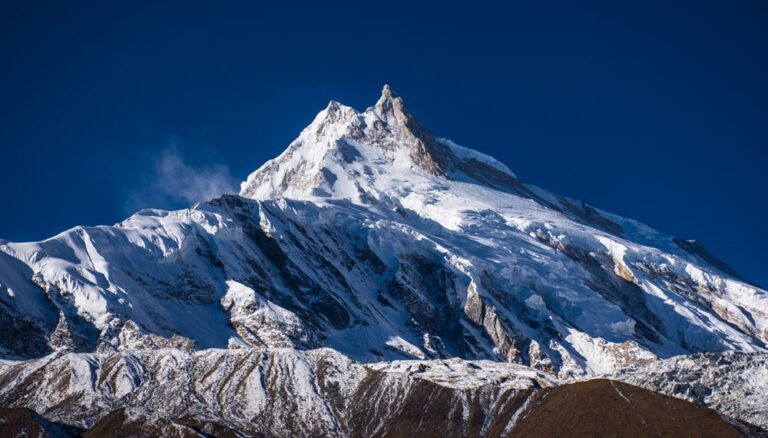
8. Mount Manaslu
Manaslu (Nepali: मनास्लु, also known as Kutang) is the eighth-highest mountain in the world at 8,163 metres (26,781 ft) above sea level. It is in the Mansiri Himal, part of the Nepalese Himalayas, in the west-central part of Nepal. The name Manaslu means "mountain of the spirit" and is derived from the Sanskrit word manasa, meaning "intellect" or "soul". Manaslu was first climbed on May 9, 1956, by Toshio Imanishi and Gyalzen Norbu, members of a Japanese expedition. It is said that, given the many unsuccessful attempts by the British to climb Everest before New Zealander Edmund Hillary, "just as the British consider Everest their mountain, Manaslu has always been a Japanese mountain". Manaslu Peak Manaslu is the highest peak in the Gorkha District and is about 64 km (40 mi) east of Annapurna. The mountain's long ridges and valley glaciers offer feasible approaches from all directions and culminate in a peak that towers steeply above its surrounding landscape and is a dominant feature when viewed from afar.
![_methode_times_prod_web_bin_76144b20-a1de-11e7-8955-1ad2a9a7928d[1]](https://hobbymart.net/wp-content/uploads/2022/03/methode_times_prod_web_bin_76144b20-a1de-11e7-8955-1ad2a9a7928d1-768x432.jpg)
![MANASALU-TREKKING[1]](https://hobbymart.net/wp-content/uploads/2022/03/MANASALU-TREKKING1-768x295.jpg)
![Mount-Manaslu-Helicopter-Tour-003[1]](https://hobbymart.net/wp-content/uploads/2022/03/Mount-Manaslu-Helicopter-Tour-0031-768x432.jpg)

9. Mount Nanga Parbat
Nanga Parbat known locally as Diamer (دیامر), is the ninth-highest mountain on Earth, its summit at 8,126 m (26,660 ft) above sea level. Lying immediately southeast of the northernmost bend of the Indus river in the Gilgit-Baltistan region of Pakistan-administered Kashmir, Nanga Parbat is the westernmost major peak of the Himalayas, and thus in the traditional view of the Himalayas as bounded by the Indus and Yarlung Tsangpo/Brahmaputra rivers, it is the western anchor of the entire mountain range. Nanga Parbat is one of the 14 eight-thousanders. An immense, dramatic peak rising far above its surrounding terrain, Nanga Parbat is known to be a difficult climb, and has earned the nickname Killer Mountain for its high number of climber fatalities.
![NangaParbat_PhYasirNisar_Getty1-56a16b3e5f9b58b7d0bf2ee0[1]](https://hobbymart.net/wp-content/uploads/2022/03/NangaParbat_PhYasirNisar_Getty1-56a16b3e5f9b58b7d0bf2ee01-768x512.jpg)
![9309014932_db03026667_b[1]](https://hobbymart.net/wp-content/uploads/2022/03/9309014932_db03026667_b1-768x503.jpg)
![nanga-parbat-2[1]](https://hobbymart.net/wp-content/uploads/2022/03/nanga-parbat-21-768x461.jpg)
![trek-nanga-parbat2[1]](https://hobbymart.net/wp-content/uploads/2022/03/trek-nanga-parbat21-768x369.jpg)

10. Mount Annapurna
Annapurna is a mountain situated in the Annapurna mountain range of Gandaki Province, north-central Nepal. It is the tenth highest mountain in the world at 8,091 metres (26,545 ft) above sea level and is well known for the difficulty and danger involved in its ascent. Maurice Herzog led a French expedition to its summit through the north face in 1950, making it the first eight-thousand meter peak ever successfully climbed. The entire massif and surrounding area are protected within the 7,629-square-kilometre (2,946 sq mi) Annapurna Conservation Area, the first and largest conservation area in Nepal. The Annapurna Conservation Area is home to several world-class treks, including Annapurna Sanctuary and Annapurna Circuit.
![GettyImages-574855961-5ad9110f642dca00369e33af[1]](https://hobbymart.net/wp-content/uploads/2022/03/GettyImages-574855961-5ad9110f642dca00369e33af1.jpg)
![image_1[1]](https://hobbymart.net/wp-content/uploads/2022/03/image_11-768x512.jpeg)