


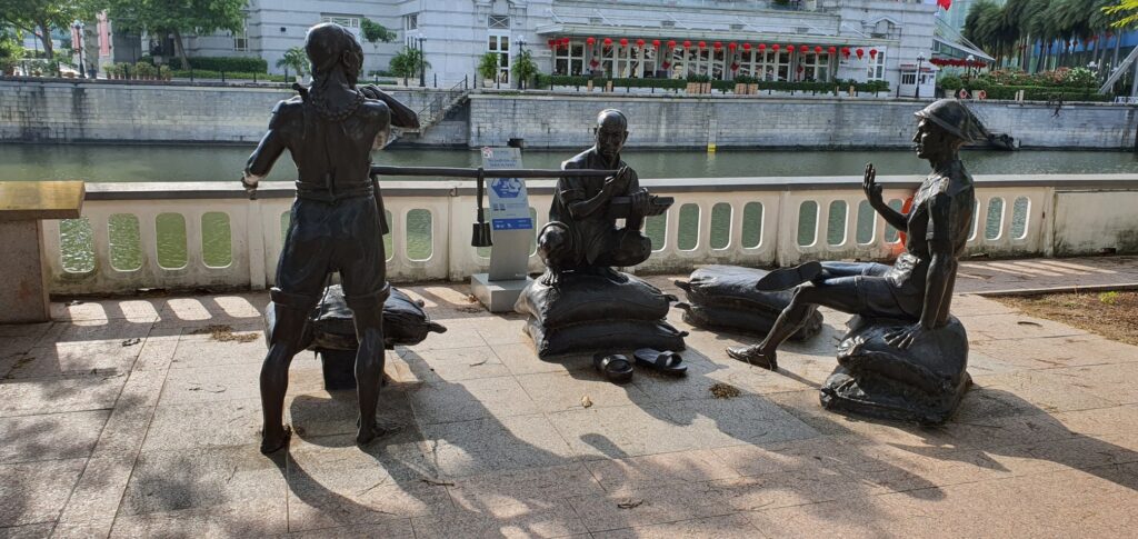


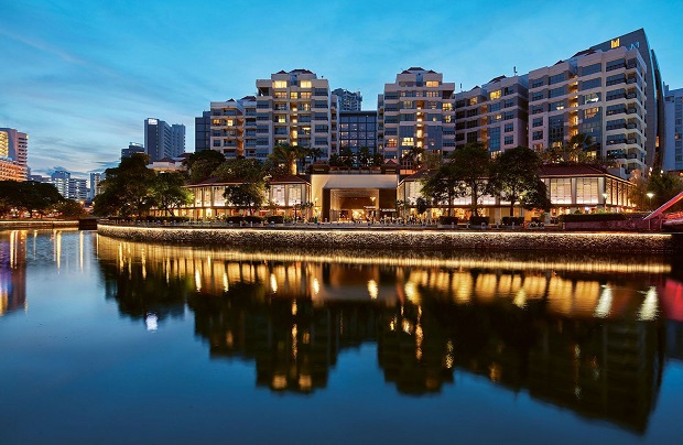

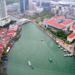
Bumboats
The term ‘bumboat’ refers to the ‘tongkang’ and ‘twakow’ lighters that transported cargoes between the banks of the Singapore River and ships anchored in the harbour.


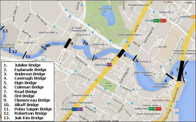

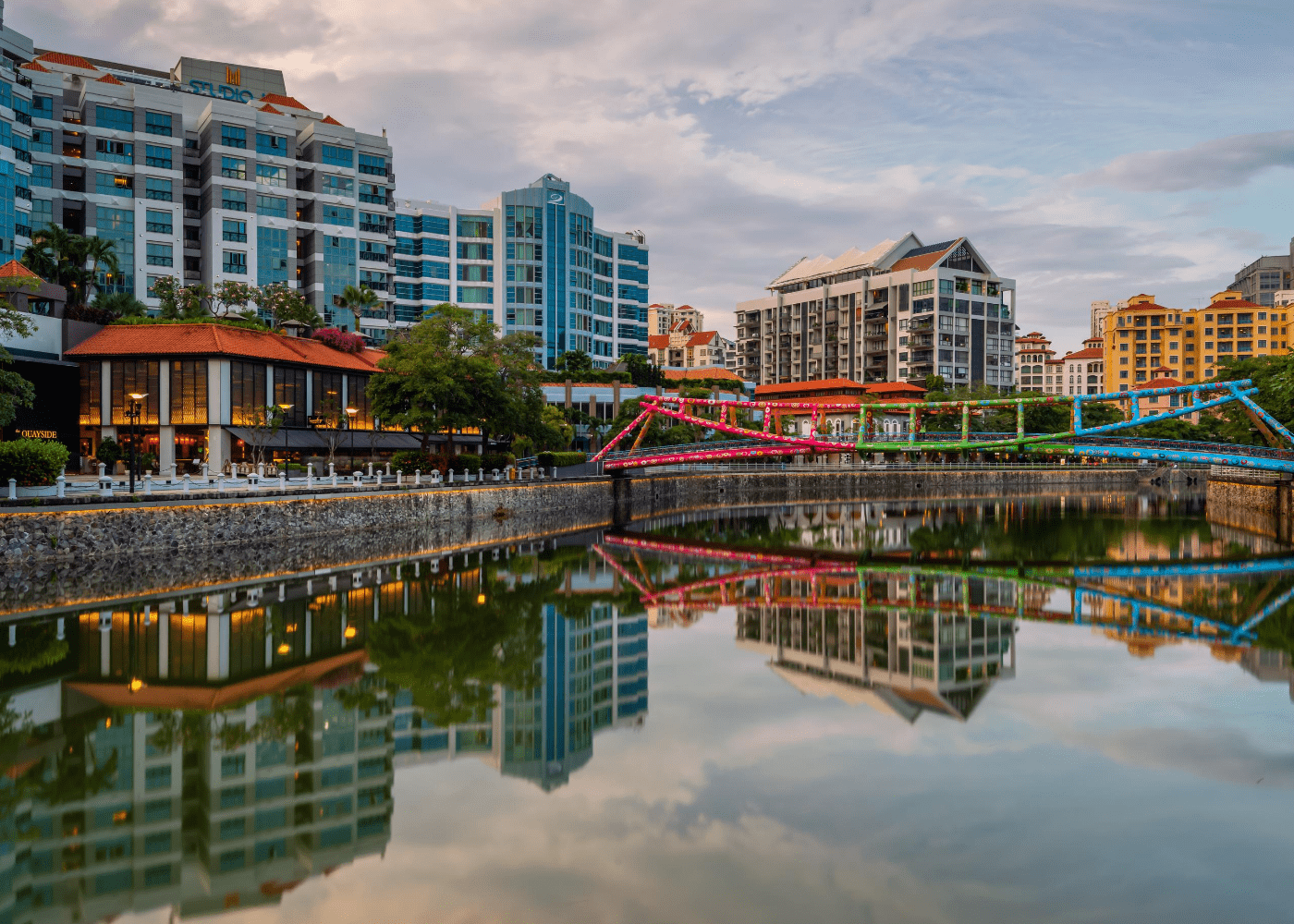
1. Jubilee Bridge (2015)
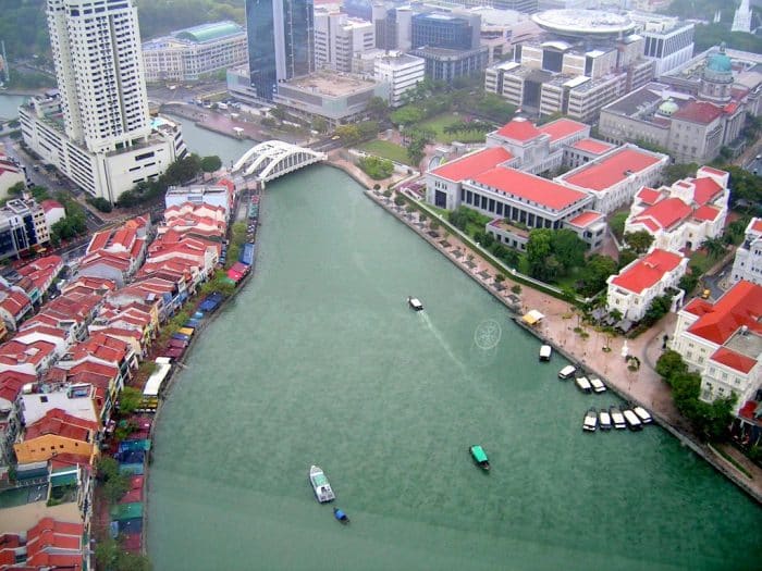
The Jubilee Bridge is a bridge over the Singapore River in Singapore. It is located in the lower reaches of the Singapore River near the mouth of the river and in the vicinity of the Esplanade Bridge in the Downtown Core planning area. Opened in 2015, it is one of the youngest bridges in Singapore.
2. Esplanade Bridge (1997)
The Esplanade Bridge is a 261-metre-long (850 ft.) road bridge that spans across the mouth of the Singapore River in Singapore with the Esplanade - Theatres on the Bay on its northern abutment and the Merlion on the southern. The 70 metre-wide (230 ft.) low-level concrete arched bridge has seven spans and supports two four-lane carriageways and walkways along both sides.

3. Anderson Bridge (1910)
Anderson Bridge is a pedestrian bridge that spans across the Singapore River. It is located near the river's mouth in the Downtown Core Planning Area of Singapore's Central Area. The bridge was completed in 1910, and was named after the Governor of the Straits Settlements and High Commissioner for the Federated Malay States, Sir John Anderson, who officially opened the bridge on 12 March 1910. It forms part of the Singapore Grand Prix's Marina Bay Street Circuit, which debuted on 28 September 2008.

4. Cavenagh Bridge (1869)
Cavenagh Bridge is the only suspension bridge and one of the oldest bridges in Singapore, spanning the lower reaches of the Singapore River in the Downtown Core. Opened in 1869 to commemorate Singapore's new Crown colony of the Straits Settlements status in 1867, it is the oldest bridge in Singapore that exists in its original form.
5. Elgin Bridge (1929)
Elgin Bridge is a vehicular box girder bridge across the Singapore River, linking the Downtown Core to the Singapore River Planning Area located within Singapore's Central Area. It was built between 1925 and 1929.

6. Coleman Bridge (1886)
Coleman Bridge is a vehicular bridge in Singapore. The bridge links Hill Street and New Bridge Road, spanning the Singapore River near Clarke Quay. Part of the bridge demarcates the boundary between the Downtown Core and the Singapore River Planning Area, both of which are located within the Central Area.

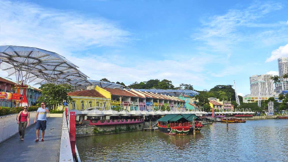
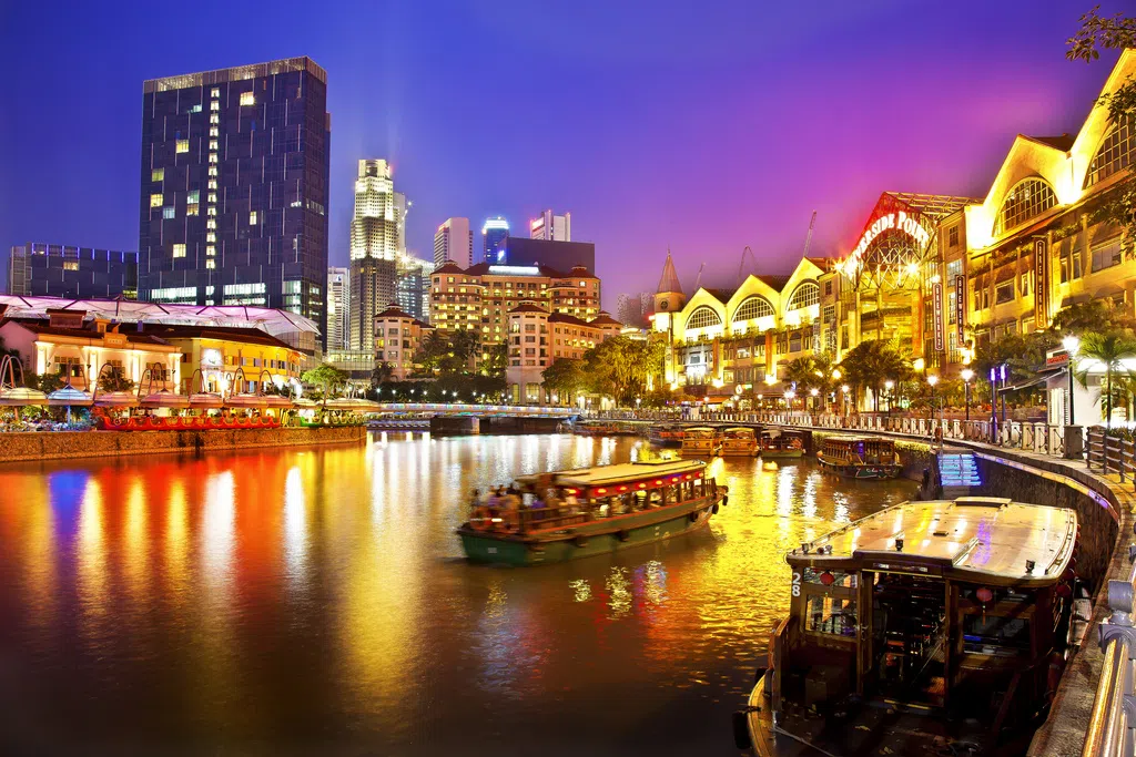
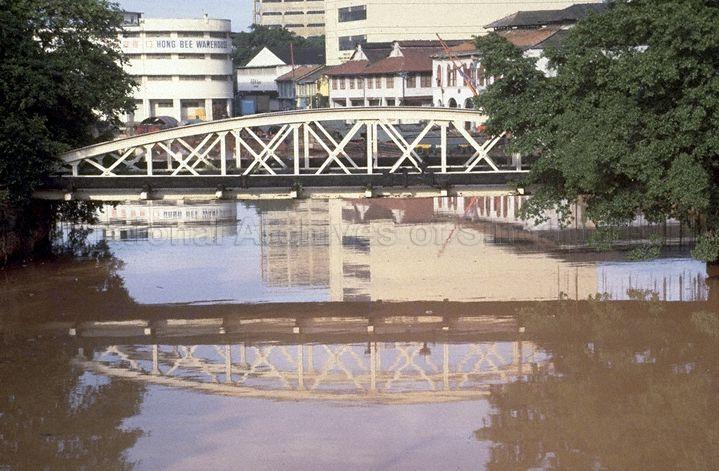
7. Read Bridge (1989)
Read Bridge(Chinese: 李德桥) is a beam-structured bridgelocated at Clarke Quaywithin the Singapore River Planning Areain Singapore. The bridge crosses the Singapore Riverlinking Clarke Quay to Swissôtel Merchant Court. The bridge was built in 1881 and completed in 1889.
8. Ord Bridge (1886)
Coleman Bridge is a vehicular bridge in Singapore. The bridge links Hill Street and New Bridge Road, spanning the Singapore River near Clarke Quay. Part of the bridge demarcates the boundary between the Downtown Core and the Singapore River Planning Area, both of which are located within the Central Area.
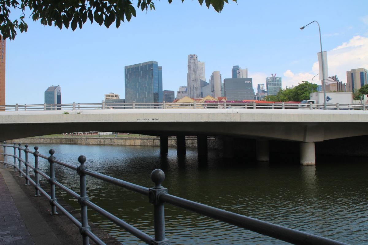
9. Clemenceau bridge (1940)
The Clemenceau Bridge is a pre-stressed concrete road bridge across the Singapore River in Singapore. The first bridge was opened in 1940 and was refurbished in 1991. It was named after French Prime Minister Georges Clemenceau, who visited Singapore in 1920.

10. Alkaff bridge (1997)
Alkaff Bridge is a pedestrian bridge in Singapore. It spans the Singapore River at Robertson Quay, located in the Singapore River planning area within the Central Area. The steel truss bridge is 55 metres in length and weighs about 230 tonnes. It is shaped like a tongkang (a light boat used commonly in the early days to carry goods along rivers), and is situated near the former Alkaff Quay. The bridge was built in 1997, as part of the Urban Redevelopment Authority's (URA) plan to create a promenade along both banks of the Singapore River.
11. Pulau Saigon bridge (1890)
Today's Pulau Saigon Bridge , named after the island of Pulau Saigon , is a box girder bridge over the Singapore River in Singapore . It is located in the Singapore River planning area in the Central region . The first bridge variant of the Pulau Saigon Bridge, which consisted of two partial bridges, was built in the 1890s and connected the then still existing island of Pulau Saigon with the two banks of the Singapore River. The bridges were demolished in 1940 and 1980 respectively, the bridge that still exists today was built a little further west in 1997.
12. Robertson bridge (1998/2000)
The Robertson Bridge is a steel arched pedestrian bridge over the Singapore River in Singapore.It is located in the Singapore River planning area and connects Havelock Road with Robertson Quay. It was built in 1998/2000. It was named after J. Murray Robertson, a councilor in Singapore. The bridge has two supporting arches that converge in the middle.
13. Jiak Kim bridge (1999)
The Jiak Kim Bridge (Chinese: 若锦桥; pinyin: Ruò jǐn qiáo) is a pedestrian bridge in Singapore. The bridge spans the Singapore River near Robertson Quay. Constructed in 1999, it was named after Tan Jiak Kim (Chinese: 陈若锦; pinyin: Chén Ruò Jǐn), grandson of famous merchant and philanthropist Tan Kim Seng and son of Tan Beng Swee (Chinese: 陈明水; pinyin: Chén Míng Shuǐ). He is also a prominent Straits-born Chinese merchant and political activist during the early 19th century.
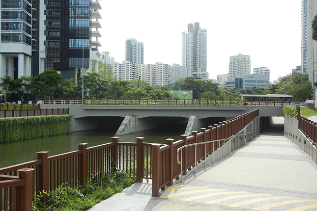
Kim Seng Bridge
Kim Seng Bridge is a road bridge in Singapore River. Singapore. The bridge is named after Tan Kim Seng, who was a Singaporean businessman and philanthropist from the Peranakan ethnic group. In 1862 Tan Kim Seng erected the first bridge on the site of today's bridge, which was named after him. It was replaced in 1890 by a new bridge. The increased traffic forced the construction of a third bridge, which was built in 1950/1951; the name has not changed. The new bridge consisted of prestressed concrete and steel. The new bridge is 20 m wide (twice as much as the predecessor bridges) and 26 m long and can carry up to 13 tonnes of weight per m².


I value the article post.Much thanks again. Fantastic.
This blog was… how do I say it? Relevant!! Finally I’ve found something which helped me. Cheers!