
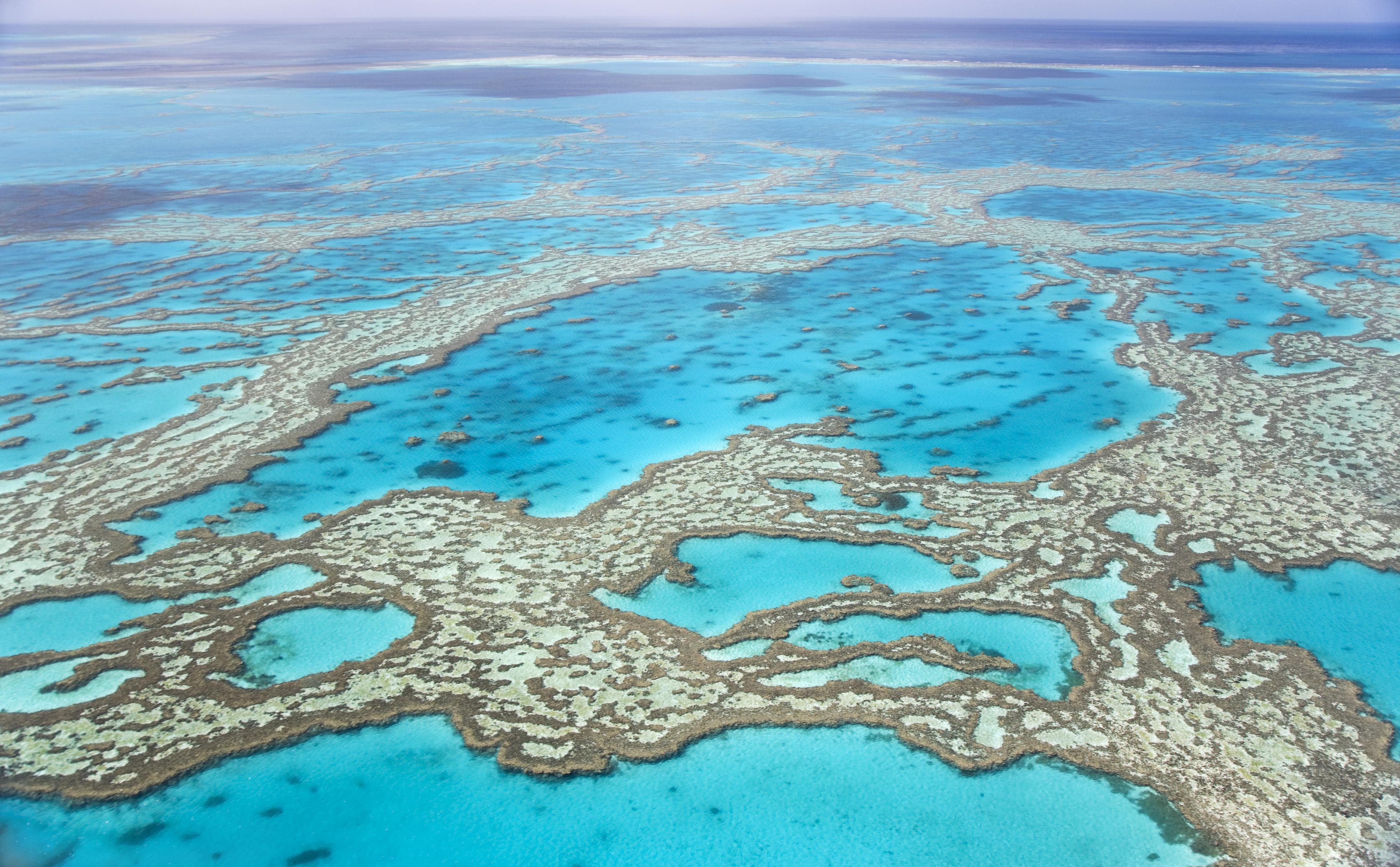
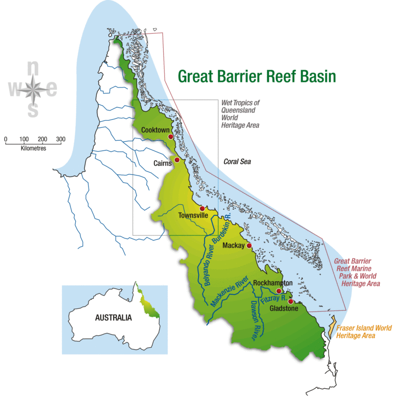
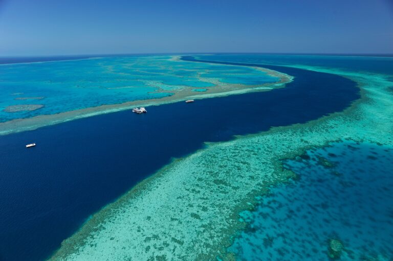
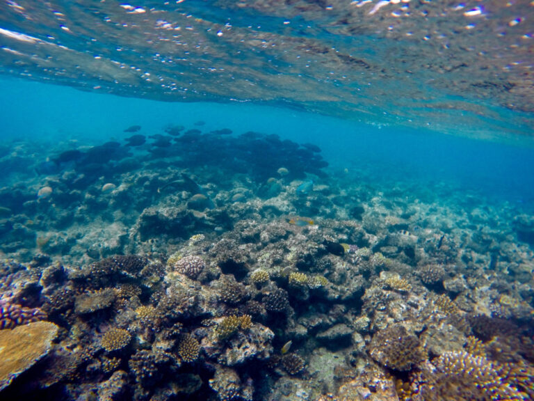
1. Great Barrier Reef (Queensland)
The Great Barrier Reef is the world's largest coral reef system composed of over 2,900 individual reefs and 900 islands stretching for over 2,300 kilometres (1,400 mi) over an area of approximately 344,400 square kilometres (133,000 sq mi). The reef is located in the Coral Sea, off the coast of Queensland, Australia, separated from the coast by a channel 100 miles wide in places and over 200 feet deep. The Great Barrier Reef can be seen from outer space and is the world's biggest single structure made by living organisms. This reef structure is composed of and built by billions of tiny organisms, known as coral polyps. It supports a wide diversity of life and was selected as a World Heritage Site in 1981. CNN labelled it one of the seven natural wonders of the world in 1997. Australian World Heritage places included it in its list in 2007. The Queensland National Trust named it a state icon of Queensland in 2006.
![reef-1[1]](https://hobbymart.net/wp-content/uploads/2022/05/reef-11-768x512.jpg)
![Great-Barrier-Reef-Queensland-Australia[1]](https://hobbymart.net/wp-content/uploads/2022/05/Great-Barrier-Reef-Queensland-Australia1-768x576.jpg)
![UaYnuNbP6L8X5qVUoAoOLf6tabs4FvNorcu0rY9y5Ek[1]](https://hobbymart.net/wp-content/uploads/2022/05/UaYnuNbP6L8X5qVUoAoOLf6tabs4FvNorcu0rY9y5Ek1-768x576.jpg)
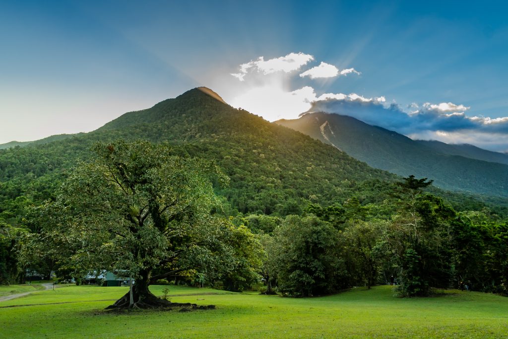
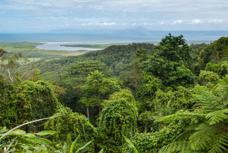
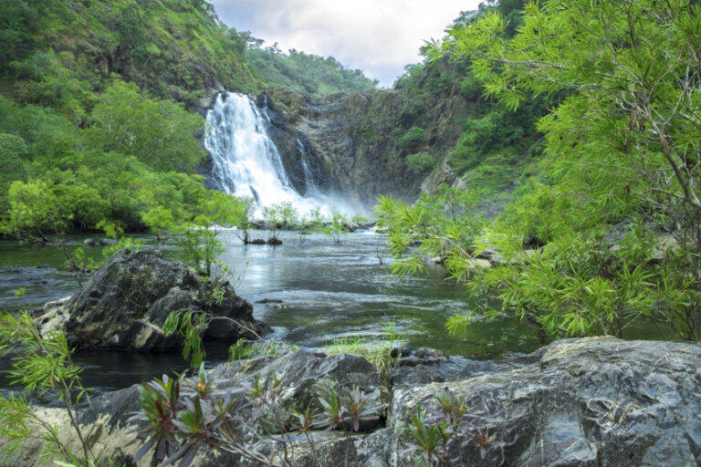
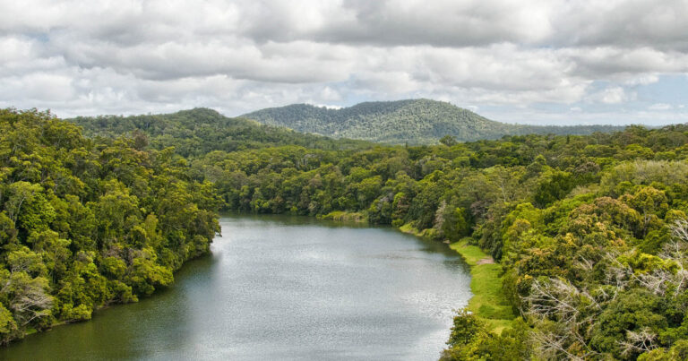
2. Daintree Rainforest (Queensland)
The Daintree Rainforest is a region on the northeast coast of Queensland, Australia, north of Mossman and Cairns. At around 1,200 square kilometres (460 sq mi), the Daintree is a part of the largest continuous area of tropical rainforest on the Australian continent. The Daintree Rainforest is a part of the Wet Tropics of Queensland Rainforest, that spans across the Cairns Region. The Wet Tropics Rainforest (that the Daintree is a part of) is the oldest continually surviving tropical rainforest in the world. Along the coastline north of the Daintree River, tropical forest grows right down to the edge of the sea. In 2009 as part of the Q150 celebrations, the Daintree Rainforest was announced as one of the Q150 Icons of Queensland for its role as a "natural attraction".
![c8690b7db4666764cbc140841fb82651[1]](https://hobbymart.net/wp-content/uploads/2022/05/c8690b7db4666764cbc140841fb826511.gif)
![destination-the-daintree-rainforest-australia[1]](https://hobbymart.net/wp-content/uploads/2022/05/destination-the-daintree-rainforest-australia1-768x336.jpg)
![videoblocks-mossman-gorge-river-in-daintree-national-park-australia_h5we0y01w_thumbnail-full01-1024x540[1]](https://hobbymart.net/wp-content/uploads/2022/05/videoblocks-mossman-gorge-river-in-daintree-national-park-australia_h5we0y01w_thumbnail-full01-1024x5401-1-768x405.png)
3. Fraser Island (Queensland)
Fraser Island (also known as K'gari and Gari) is a World Heritage-listed island along the south-eastern coast in the Wide Bay–Burnett region, Queensland, Australia. The island is approximately 250 kilometres (160 mi) north of the state capital, Brisbane, and is within the Fraser Coast Region local government area. The world heritage listing includes the island, its surrounding waters and parts of the nearby mainland. Fraser Island, and some satellite islands off the southern west coast and thus in the Great Sandy Strait, form the County of Fraser, which is subdivided into six parishes. Among the islands are Slain Island, Tooth Island, Roundbush Island, Moonboom Island, Gardner Island, Dream Island, Stewart Island, and the Reef Islands, all part of the southernmost parish of Talboor.
![remote-fraser-island-tour-tasman-5eb1f204698261934fad6890[1]](https://hobbymart.net/wp-content/uploads/2022/05/remote-fraser-island-tour-tasman-5eb1f204698261934fad68901-768x432.jpeg)
![untitled-0547-Pano-Edit[1]](https://hobbymart.net/wp-content/uploads/2022/05/untitled-0547-Pano-Edit1-768x349.jpg)
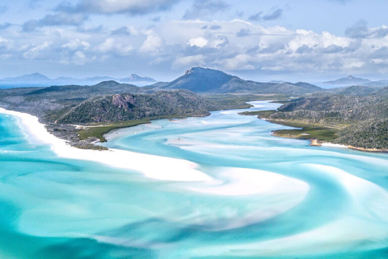
4. Whitsundays (Queensland)
Whitsundays is an island group locality in the Whitsunday Region, Queensland, Australia. It mostly consists of the Whitsunday Group of islands off the Queensland east coast in the Coral Sea, a mix of inhabited and uninhabited islands. In the 2016 census, Whitsundays had a population of 2,269 people.
![whitsunday-island-map[1]](https://hobbymart.net/wp-content/uploads/2022/05/whitsunday-island-map1-768x512.jpg)
![WFD-1[1]](https://hobbymart.net/wp-content/uploads/2022/05/WFD-11-768x532.jpg)
![whitehaven-beach-92601-ws[1]](https://hobbymart.net/wp-content/uploads/2022/05/whitehaven-beach-92601-ws1-768x432.jpg)
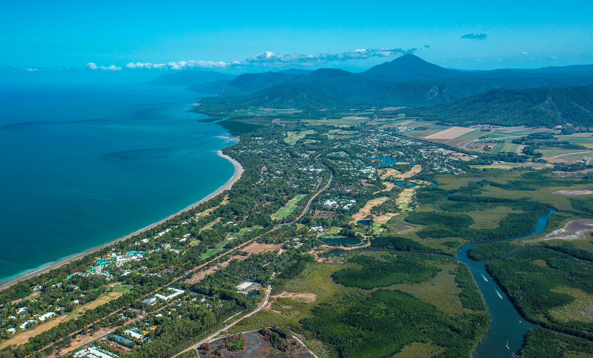
5. Port Douglas (Queensland)
Port Douglas is a coastal town and locality in the Shire of Douglas, Queensland, approximately 60 km north of Cairns. In the 2016 census, Port Douglas had a population of 3,504 people. The town's population can often double, however, with the influx of tourists during the peak tourism season from May to September. The town is named in honour of a former Premier of Queensland, John Douglas. Port Douglas developed quickly based on the mining industry. Other parts of the area were established with timber cutting occurring in the area surrounding the Daintree River and with settlement starting to occur on lots around the Mossman River by 1880.
![pd2-703x469[1]](https://hobbymart.net/wp-content/uploads/2022/05/pd2-703x4691-1.jpg)
![aerial-of-port-douglas-31696[1]](https://hobbymart.net/wp-content/uploads/2022/05/aerial-of-port-douglas-316961-768x515.jpg)
![PD-marina[1]](https://hobbymart.net/wp-content/uploads/2022/05/PD-marina1-768x432.jpg)

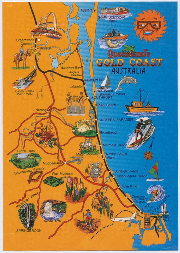
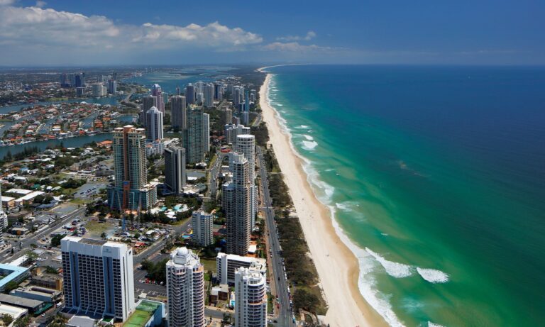
6. Gold Coast (Queensland)
The Gold Coast is a coastal city in the state of Queensland, Australia, approximately 66 kilometres (41 mi) south-southeast of the centre of the state capital Brisbane and immediately north of the border with New South Wales. The area was previously occupied prior to European settlement by the Yugambeh language people. The demonym for the Gold Coast is Gold Coaster. With an estimated population of 679,127 in June 2018 (including 79,001 in the adjacent Tweed Valley of New South Wales), the Gold Coast is the sixth-largest city in Australia, Australia's largest non-capital city, and Queensland's second-largest city. The Gold Coast is a major tourist destination with a sunny, subtropical climate and has become widely known for its world-class surfing beaches, high-rise dominated skyline, theme parks, nightlife, and rainforest hinterland. The city is part of the nation's entertainment industry with television productions and a major film industry.
![shutterstockRF_550879138-d5b90d9affbb[1]](https://hobbymart.net/wp-content/uploads/2022/05/shutterstockRF_550879138-d5b90d9affbb1-768x576.jpg)
![gold-coast-city-guide-gold-coast-qld[1]](https://hobbymart.net/wp-content/uploads/2022/05/gold-coast-city-guide-gold-coast-qld1-768x431.jpg)
![2_gy72p3[1]](https://hobbymart.net/wp-content/uploads/2022/05/2_gy72p31-768x432.jpg)
![GCT_aerial-gold-coast-australia-broadwater-56b7d1015f9b5829f83c3427[1]](https://hobbymart.net/wp-content/uploads/2022/05/GCT_aerial-gold-coast-australia-broadwater-56b7d1015f9b5829f83c34271-768x511.jpg)

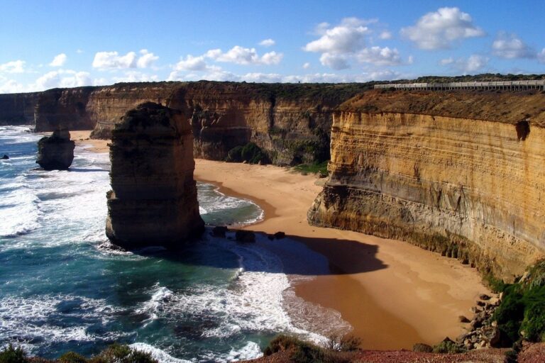
7. Twelve Apostles (Victoria)
The Twelve Apostles is a collection of limestone stacks off the shore of Port Campbell National Park, by the Great Ocean Road in Victoria, Australia. Their proximity to one another has made the site a popular tourist attraction. Seven of the original eight stacks remain standing at the Twelve Apostles viewpoint, after one collapsed in July 2005. Though the view from the promontory by the Twelve Apostles never included twelve stacks, additional stacks—not considered part of the Apostles group—are located to the west within the national park.
![ocean-road-map[1]](https://hobbymart.net/wp-content/uploads/2022/05/ocean-road-map1-768x510.jpg)
![Twelve-Apostles-Victoria-Australia[1]](https://hobbymart.net/wp-content/uploads/2022/05/Twelve-Apostles-Victoria-Australia1-768x512.jpg)
![140532-23[1]](https://hobbymart.net/wp-content/uploads/2022/05/140532-231-768x430.jpg)
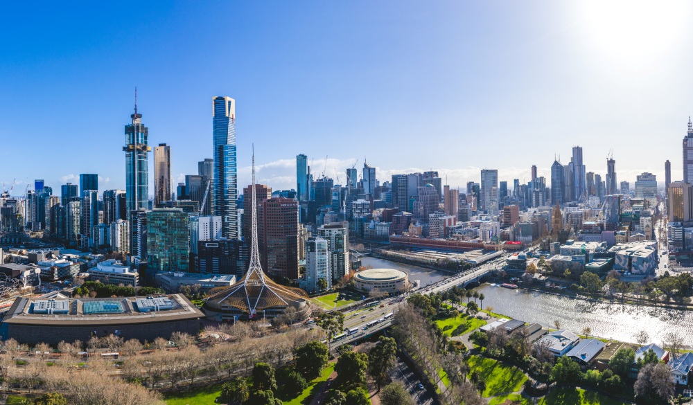
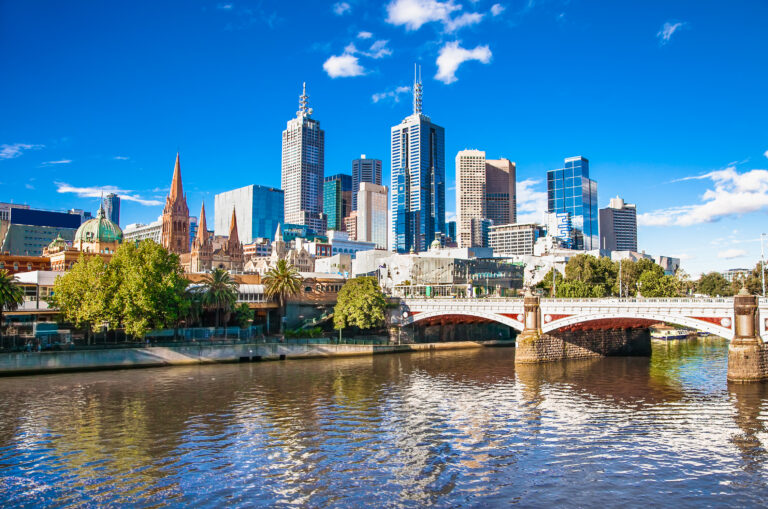
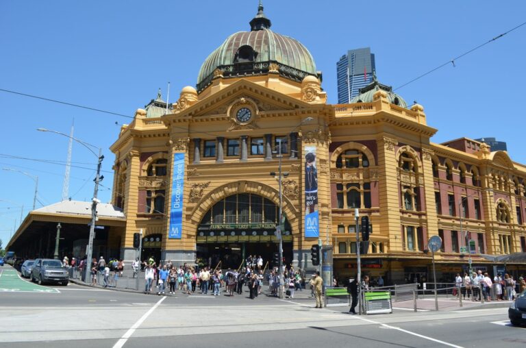
8. Melbourne (Victoria)
Melbourne is the capital and most-populous city of the Australian state of Victoria, and the second-most populous city in both Australia and Oceania. Its name generally refers to a 9,993 km2 (3,858 sq mi) metropolitan area known as Greater Melbourne, comprising an urban agglomeration of 31 local municipalities, although the name is also used specifically for the local municipality of City of Melbourne based around its central business area. The city occupies much of the northern and eastern coastlines of Port Phillip Bay and spreads into the Mornington Peninsula and the hinterlands towards the Yarra Valley and the Dandenong and Macedon Ranges. It has a population over 5 million (19% of the population of Australia, as per 2020), mostly residing to the east side of the city centre, and its inhabitants are commonly referred to as "Melburnians".
![06bee573be38adbc2e1b57ba9a80b0f6[1]](https://hobbymart.net/wp-content/uploads/2022/05/06bee573be38adbc2e1b57ba9a80b0f61.jpg)
![melbourne-autumn-xlarge[1]](https://hobbymart.net/wp-content/uploads/2022/05/melbourne-autumn-xlarge1-768x480.jpg)
![melbourne2019-aerial[1]](https://hobbymart.net/wp-content/uploads/2022/05/melbourne2019-aerial1-768x512.jpg)
![1528759716289-768x510[1]](https://hobbymart.net/wp-content/uploads/2022/05/1528759716289-768x5101-1.jpg)
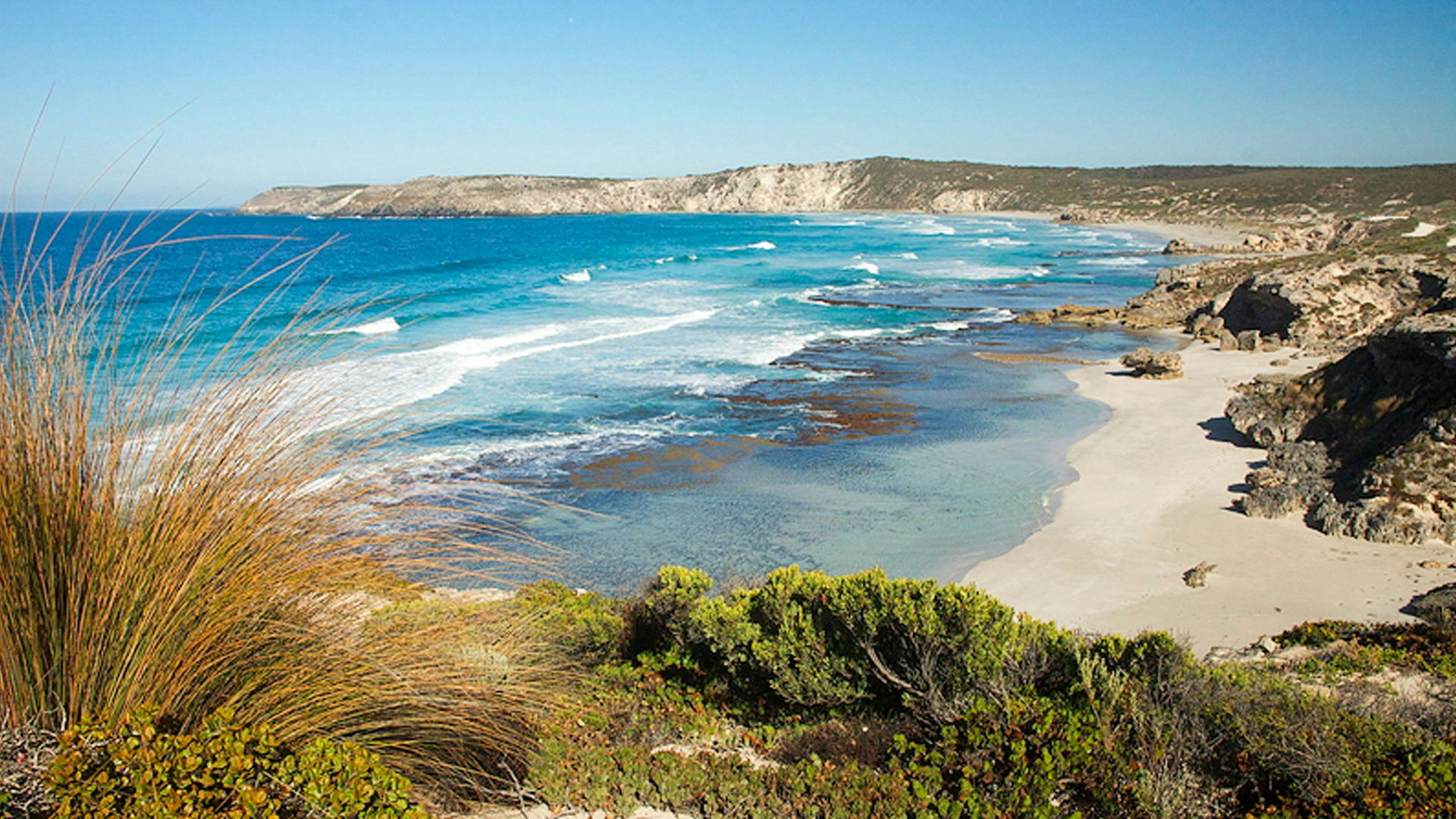
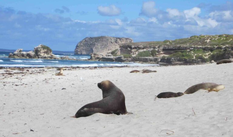
9. Kangaroo Island (South Australia)
Kangaroo Island, also known as Karta Pintingga (literally 'Island of the Dead' in the language of the Kaurna people), is Australia's third-largest island, after Tasmania and Melville Island. It lies in the state of South Australia, 112 km (70 mi) southwest of Adelaide. Its closest point to the mainland is Snapper Point in Backstairs Passage, which is 13.5 km (8.4 mi) from the Fleurieu Peninsula. Kangaroo Island is also considered to be one of South Australia's best locations for scuba diving, with many popular locations along the north coast. Many of South Australia's iconic marine species can be seen there, including the Leafy seadragon. Penneshaw jetty is known for its Gorgonian corals and there are many other timber jetties and shipwrecks that can be dived and enjoyed around the island.
![kangaroo-island-map[1]](https://hobbymart.net/wp-content/uploads/2022/05/kangaroo-island-map1.jpg)
![oceanview-aerial-resize-web[1]](https://hobbymart.net/wp-content/uploads/2022/05/oceanview-aerial-resize-web1-768x432.jpg)
![fa[1]](https://hobbymart.net/wp-content/uploads/2022/05/fa1-768x512.jpg)
![oceanview-aerial-resize-web[3]](https://hobbymart.net/wp-content/uploads/2022/05/oceanview-aerial-resize-web3-768x432.jpg)
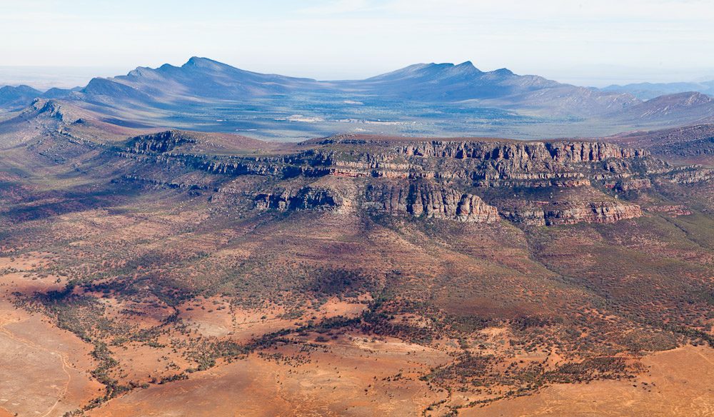
10. Wilpena Pound (South Australia)
Wilpena Pound is a natural amphitheatre of mountains located 429 kilometres (267 mi) north of Adelaide, South Australia, Australia in the heart of the Ikara-Flinders Ranges National Park. It is accessible via a sealed road which continues on to the northern Flinders Ranges town of Blinman and to the south, Hawker. Attempts at farming the Pound failed during the early 20th century. Following this, the tourism potential was recognised in 1945.
![rooms-map-wilpena-june-2017_5[1]](https://hobbymart.net/wp-content/uploads/2022/05/rooms-map-wilpena-june-2017_51-768x543.png)
![wilpena_pound_flight_127276[1]](https://hobbymart.net/wp-content/uploads/2022/05/wilpena_pound_flight_1272761.jpg)
![h-c-au-sa-wilpena-pound-from-the-air-148811363-g-rf-cropped-cc-web-16-9[1]](https://hobbymart.net/wp-content/uploads/2022/05/h-c-au-sa-wilpena-pound-from-the-air-148811363-g-rf-cropped-cc-web-16-91-768x432.jpg)
![r0_85_2953_1752_w1200_h678_fmax[1]](https://hobbymart.net/wp-content/uploads/2022/05/r0_85_2953_1752_w1200_h678_fmax1-768x433.jpg)
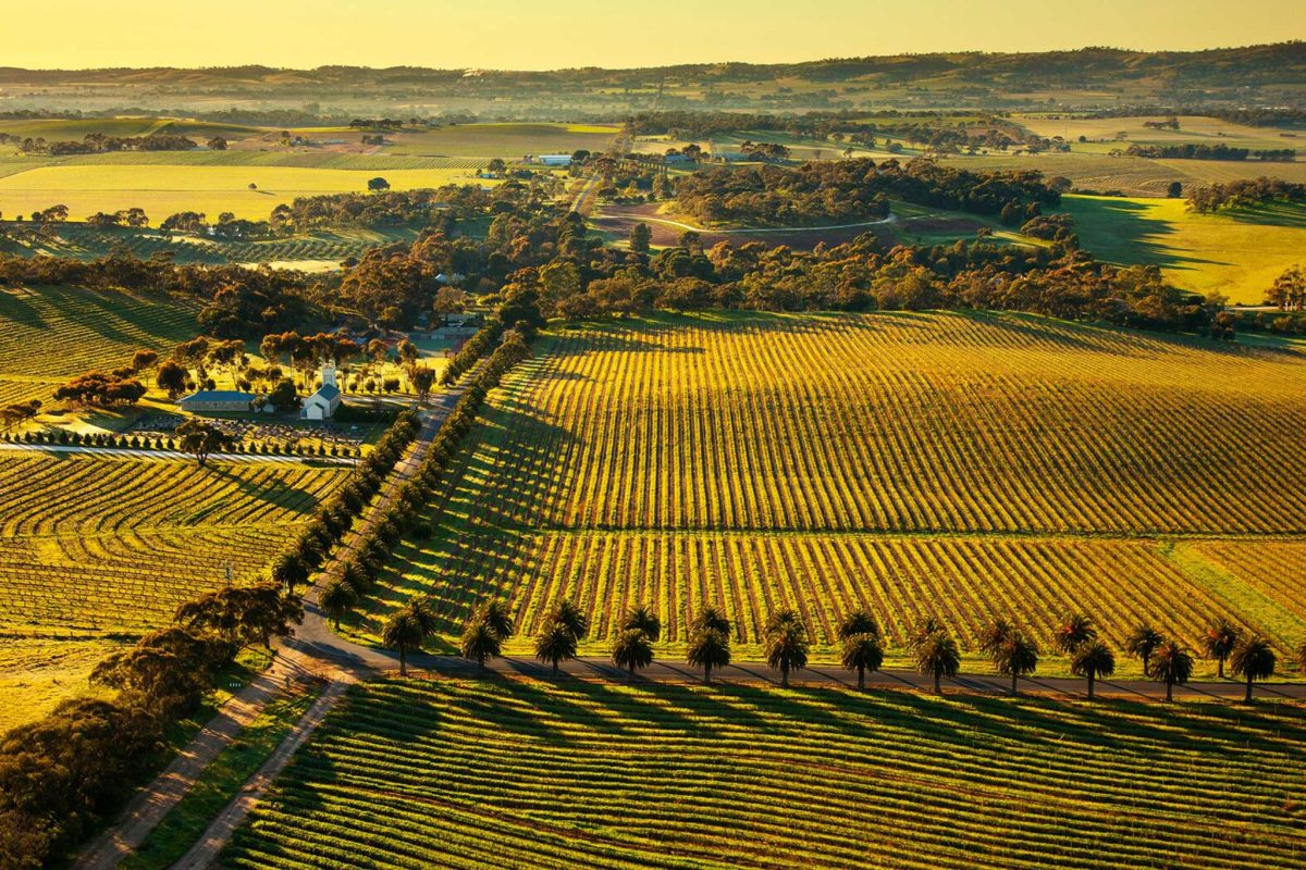
11. Barossa Valley (South Australia)
The Barossa Valley (Barossa German: Barossa Tal) is a valley in South Australia located 60 kilometres (37 mi) northeast of Adelaide city centre. The valley is formed by the North Para River. It is notable as a major wine-producing region and tourist destination. The Barossa Valley Way is the main road through the valley, connecting the main towns on the valley floor of Nuriootpa, Tanunda, Rowland Flat and Lyndoch. The Barossa Trail walking and cycling path is 40 kilometres (25 mi) long and also passes the main towns from near Gawler on the Adelaide Plains to Angaston to the east of the valley.
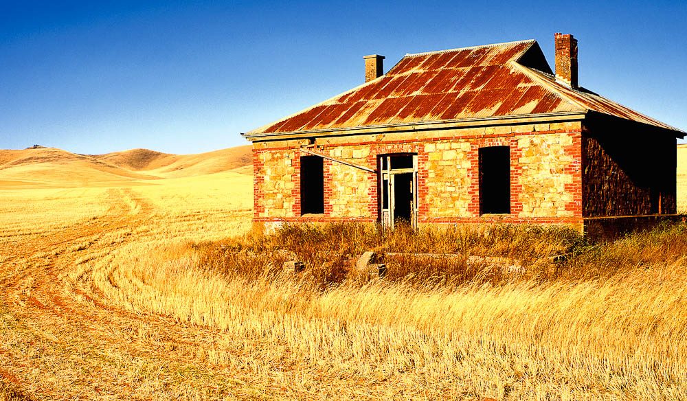
12. Burra Homestead (South Australia)
Burra is an Australian locality of rural smallholdings lying 20 kilometres to the south of Queanbeyan, New South Wales in the Queanbeyan-Palerang Region. At the 2016 census, Burra had a population of 794 people.

13. Lake Gairdner (South Australia)
Lake Gairdner is a large endorheic salt lake in the Australian state of South Australia, to the north of the Eyre Peninsula. When in flood, the lake is considered the third largest salt lake in Australia. Lake Gairdner is located about 440 kilometres (270 mi) northwest of the state capital of Adelaide and about 150 kilometres (93 mi) northwest of Port Augusta in the foothills on the northern side of the Gawler Ranges and to the west of Lake Torrens.[citation needed] The lake is over 160 km (99 mi) long and 48 km (30 mi) across with salt over 1.2 metres (3 ft 11 in) thick in some places.[citation needed]

14. Sydney Opera House (New South Wales)
The Sydney Opera House is a multi-venue performing arts centre in Sydney. Located on the banks of Sydney Harbour, it is widely regarded as one of the world's most famous and distinctive buildings and a masterpiece of 20th century architecture. Designed by Danish architect Jørn Utzon, but completed by an Australian architectural team headed by Peter Hall, the building was formally opened on 20 October 1973 after a gestation beginning with Utzon's 1957 selection as winner of an international design competition. The Government of New South Wales, led by the premier, Joseph Cahill, authorised work to begin in 1958 with Utzon directing construction. The government's decision to build Utzon's design is often overshadowed by circumstances that followed, including cost and scheduling overruns as well as the architect's ultimate resignation.

15. Blue Mountains (New South Wales)
The Blue Mountains are a mountainous region and a mountain range located in New South Wales, Australia. The region borders on Sydney's metropolitan area, its foothills starting about 50 kilometres (31 mi) west of centre of the state capital, close to Penrith on the outskirts of Greater Sydney region. The public's understanding of the extent of the Blue Mountains is varied, as it forms only part of an extensive mountainous area associated with the Great Dividing Range. As defined in 1970, the Blue Mountains region is bounded by the Nepean and Hawkesbury rivers in the east, the Coxs River and Lake Burragorang to the west and south, and the Wolgan and Colo rivers to the north. Geologically, it is situated in the central parts of the Sydney Basin.
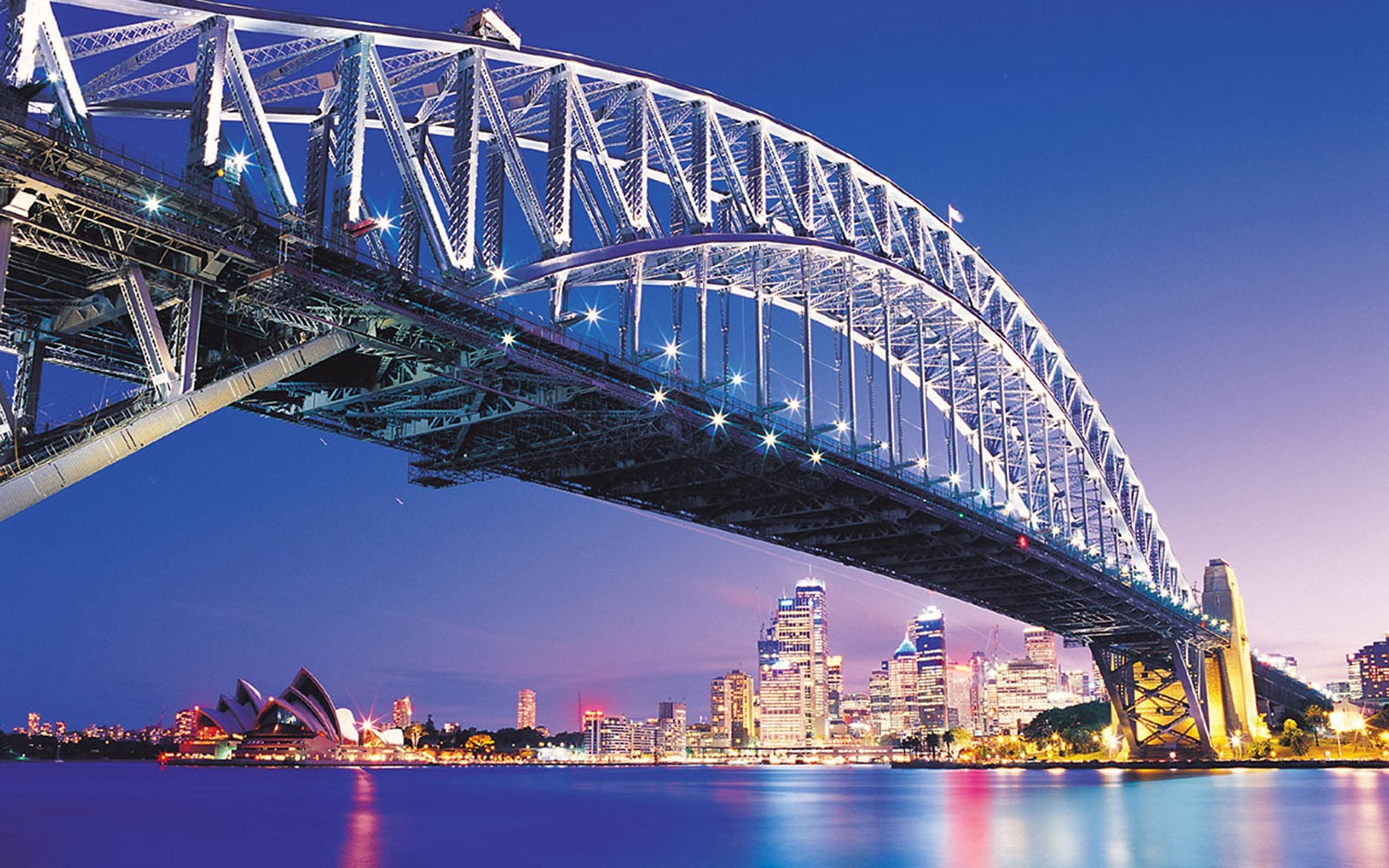
16. Sydney Harbour Bridge (New South Wales)
The Sydney Harbour Bridge is a heritage-listed steel through arch bridge in Sydney, spanning Sydney Harbour from the central business district (CBD) to the North Shore. The view of the bridge, the harbour, and the nearby Sydney Opera House is widely regarded as an iconic image of Sydney, and of Australia itself. Nicknamed "The Coathanger" because of its arch-based design, the bridge carries rail, vehicular, bicycle and pedestrian traffic.

17. Uluru (Northern Australia)
Uluru is a large sandstone formation in the centre of Australia. It is in the southern part of the Northern Territory, 335 km (208 mi) southwest of Alice Springs. Uluru is sacred to the Pitjantjatjara, the Aboriginal people of the area, known as the Aṉangu. The area around the formation is home to an abundance of springs, waterholes, rock caves, and ancient paintings. Uluru is listed as a UNESCO World Heritage Site. Uluru and Kata Tjuta, also known as the Olgas, are the two major features of the Uluṟu-Kata Tjuṯa National Park. Uluru is one of Australia's most recognisable natural landmarks and has been a popular destination for tourists since the late 1930s. It is also one of the most important indigenous sites in Australia.

18. Hamelin Bay Stingrays (Western Australia)
Hamelin Bay is a bay and a locality on the southwest coast of Western Australia between Cape Leeuwin and Cape Naturaliste. It is named after French explorer Jacques Félix Emmanuel Hamelin, who sailed through the area in about 1801. It is south of Cape Freycinet. To the north, the beach leads to the Boranup Sand Patch and further to the mouth of the Margaret River, while south leads to Cape Leeuwin. The nearest locality to the east is Karridale on the Margaret River to Augusta road. It was also a small settlement and port in Western Australia on the coast of the Leeuwin-Naturaliste Ridge.

19. Pinnacles (Western Australia)
The Pinnacles are limestone formations within Nambung National Park, near the town of Cervantes, Western Australia. The Pinnacles remained unknown to most Australians until 1967 when the area was gazetted as a reserve, which was later combined with two adjacent reserves to form Nambung National Park in 1994. Nambung National Park received about 150,000 visitors a year as of 2011. The Pinnacles Desert Discovery Centre was opened in 2008, offering interpretive displays of the park, both the natural processes that formed the Pinnacles and the biodiversity of the area.
20. Cable Beach (Western Australia)
Cable Beach is a 22 km (14 mi) stretch of white sand beach on the eastern Indian Ocean and the name of the surrounding suburb in Broome, Western Australia. Cable Beach was named after the telegraph cable laid between Broome and Java in 1889. Low cliffs of red ochre rise behind the very flat and wide beach, with waves that are mostly gentle in the dry season from May to October. In 2016, the population was 5,436.
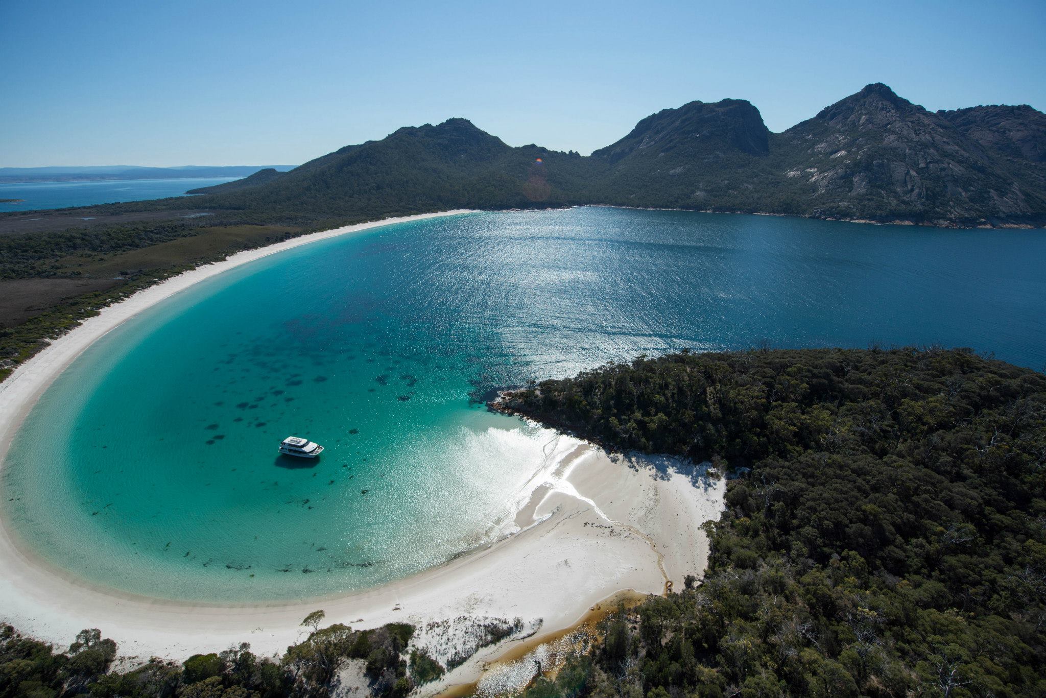
21. Wine Glass Bay (Tasmania)
The Tubbataha Natural Park is a protected area of the Philippines located in the middle of the Sulu Sea. The marine and bird sanctuary consists of two huge atolls (named the North Atoll and South Atoll) and the smaller Jessie Beazley Reef covering a total area of 97,030 hectares (239,800 acres; 374.6 sq mi). It is located 150 kilometres (93 mi) southeast of Puerto Princesa, the capital of Palawan. The uninhabited islands and reefs are part of the island municipality of Cagayancillo, located roughly 130 kilometers (81 mi) to the northeast of the reef. In December 1993, the UNESCO declared the Tubbataha Reefs National Park as a World Heritage Site as a unique example of an atoll reef with a very high density of marine species; the North Islet serving as a nesting site for birds and marine turtles.

22. Maria Island (Tasmania)
Maria Island is a mountainous island located in the Tasman Sea, off the east coast of Tasmania, Australia. The 115.5-square-kilometre (44.6 sq mi) island is contained within the Maria Island National Park, which includes a marine area of 18.78 square kilometres (7.25 sq mi) off the island's northwest coast. The island is about 20 kilometres (12 mi) in length from north to south and, at its widest, is about 13 kilometres (8.1 mi) west to east. At its closest point, Point Lesueur, the island lies approximately 4 kilometres (2.5 mi) off the east coast of Tasmania.